The waterways are undoubtedly a wonderful feature of life on the Gold Coast. They provide numerous social and leisure opportunities, and their contribution to the local economy is significant.
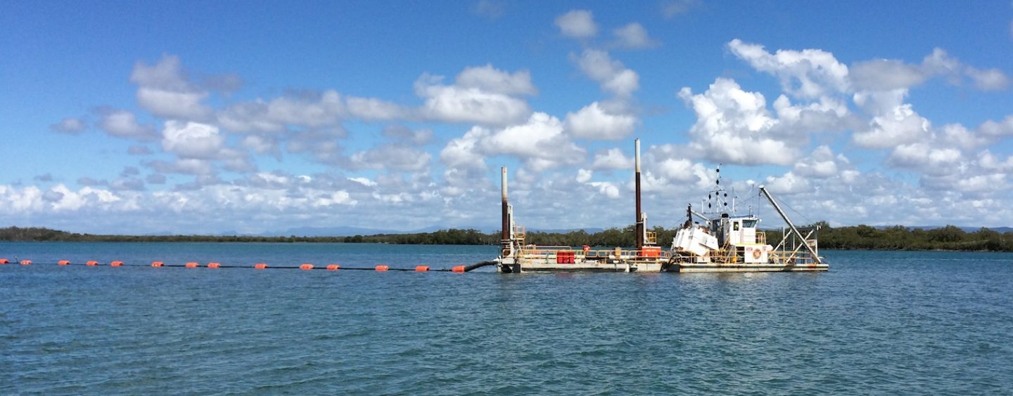
Gold Coast Waterways Authority (GCWA) plays a key role in managing and improving the waterways so their important value is protected into the future. As well as day-to-day operations and the delivery of major projects, such as the improvements to Doug Jennings Park, one of GCWA’s key workstreams is its dredging program.
The waterways are a complex system of naturally shallow areas and channels that are affected by tides, weather conditions and build-up of sediment. The movement of sand is part of a dynamic coastal system and it can cause channels to become too narrow or shallow to safely navigate. Dredging is vital maintenance for the waterways and helps ensure they are safe for everyone to use.
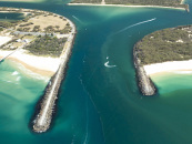
Over Winter 2018, GCWA delivered major dredging projects in the Broadwater’s North and Labrador channels, helping our waterways remain world class and accessible for residents and visitors.
“The projects in the Broadwater were just the latest in our programme to improve access to the Gold Coast’s wonderful waterways, and builds on the $8.5 million we have invested in recent years,” Hal Morris, CEO of GCWA, says. “The Labrador and North channels are two of the busiest channels on the Gold Coast, providing access to the Gold Coast Seaway, the Broadwater and into the city’s waterways network. Through the course of the dredging projects, we removed over 46,000m of sand. That’s enough to fill about 6,000 medium-sized skips. The dredging of the channels has successfully tackled the shoaling that was building up, with the dredged sand used for beach nourishment along the Anglers Esplanade foreshore and the northern beach of Wave Break Island.”
Over the next four years, GCWA will be investing almost $15 million to keep the waterways open and available to everyone, including a project dredge of the Canaipa Passage over Autumn 2018. The dredging in the Canaipa Passage will be focused on the navigation channel opposite Slipping Sands and the Russell Island junction. In the new year, work will start on a major project to dredge the Coomera River, which will improve navigational access to Coomera’s growing marine industry as well as helping to mitigate the risk of flooding along the river.
“For all our dredging projects, a Notice to Mariners is issued. All vessels passing through a dredge area should navigate with caution and at minimum speed to ensure vessel wash does not affect the safe operation of the dredge and support vessels,” Hal Morris reiterates. “We always work to keep disruption to a minimum, and we thank everyone for their patience and understanding while we deliver our vital dredging projects.”
Keep up-to-date with GCWA’s dredging program as well as other latest news and information by following them on Facebook: GoldCoastWaterwaysAuthority.
DREDGE NAVIGATION MARKS & SIGNS
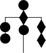
A vessel restricted in its ability to manoeuvre and engaged in dredging or underwater operations will display these day shapes when an obstruction is present. The safe side to pass a dredge displaying these symbols is on the same side that the dredge is displaying the two vertical diamond symbols. An easy way to remember this is that an isolated danger mark has two vertical spheres, and that the side of the dredge displaying the two vertical spheres has a dangerous obstruction present.
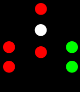
At night, a dredge in the same operational conditions will be displaying the lights in this diagram. The safe side to pass is the side with the two vertical green lights (the side the two vertical diamonds would be visible during the day). The dangerous obstruction side is the side with the two vertical red lights (the side the two vertical spheres would be visible during the day).
If the dredge is making way through the water, in addition to these lights, it will also display a white masthead light or lights, a white sternlight, and port and starboard sidelights.


