CRUISING QUEENSLAND’S EAST COAST
By Coastal Cruising Club of Australia
For yachts cruising north from “the south”, there is an entirely different world after Southport. For a start, overnight passages are entirely optional, because there are many secure anchorages available right up the coast. The other thing is scale. Queensland is BIG – the distance from Southport to Thursday Island is similar to that from London to Moscow, or Florida to Maine. Likewise, many of the anchorages are huge. Finally, most of the cruise is swell free because you can use sheltered waterways in the south. From Gladstone north, the reef cuts off the ocean swell. In fact, in the whole east coast, there is only about 160 miles open to ocean swell, and in these areas the swell is usually much less than further south. Add a mild winter climate and it is clear why this is the most favoured winter cruising destination for cruising boat owners and for bareboat chartering.
Most cruising folk think of the coast as in four sections: Southport to Rosslyn Bay, Rosslyn Bay to Whitsundays, Whitsundays to Lizard Island and north of Lizard Island. Unless one is considering a circumnavigation of Australia, the Pacific or the world, Lizard Island is usually the farthest limit of a winter cruise.
SOUTHPORT TO ROSSLYN BAY
Distance 374 nm, commonly 10-day sails
This section includes 185 nm via the passages inside North Stradbroke and Moreton Islands (Moreton Bay), the Great Sandy Straits inside Fraser Island (Hervey Bay), and the Narrows inside Curtis Island. All these are sheltered inshore passages with lots of sheltered anchorages. You do have to watch the tide and be careful with markers, but for the most part the water is flat and safe (for ocean-going yachts) even in strong winds. Crossing the Wide Bay Bar at the southern end of Fraser Island requires careful attention to weather and tides: you have to leave Mooloolaba just in time to have good conditions and a run in half-tide or more on the bar after a 55 nm passage.
 Luckily, Mooloolaba is a great place to wait in, with good surfing, good fish restaurants and nice hinterland, and great social life with all the cruising types waiting with you! There are also three marinas and good repair facilities. By Queensland standards, you are close to civilisation for this whole distance, except for the Bundaberg-Pancake Creek leg.
Most of us think Pancake Creek is the first “wild” anchorage of the cruise. In this section, it is possible to cruise up on the reef by using Lady Musgrave Island and Fitzroy Reef, but you need to be very capable or have very nice weather for this.
ROSSLYN BAY TO WHITSUNDAYS
Distance 240 nm, commonly 7-day sails
With the exception of the first 70 nm, this section covers all islands, and is the most remote section of the normal cruise. The section from Island Head Creek to the Whitsundays or Mackay is often called “the paddock” or “the hundred rolling miles”. Actually, from Island Head Creek to Mackay is 180 nm. It also includes magical uninhabited islands with clear waters and beautiful beaches.
The Percy Islands are right in the middle and known among cruising sailors for secluded anchorages and coconut tree-lined beaches amid heavily forested islands.
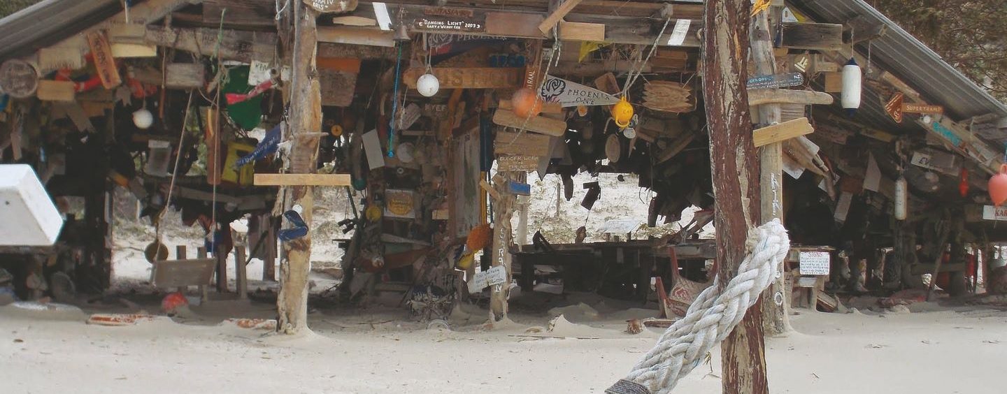
An A-frame structure was erected at West Beach on Middle Percy. For years, it has been a gathering point for cruising yachties. Many visiting sailors have added boat name plaques, creating an eclectic collection of odd items from all over the world. This intriguing collection, ranges from a pair of aqua cylinders, fishing floats and driftwood, to varnished name boards, most of which are to be found in the “phone shed” next door, which once contained the winch for hauling the vessel Islander up the beach, and the phone which was connected to the residence. Islander is the sailing vessel built by the White family who once lived and raised cattle on the island.
Marble Island is the jewel in the crown of the Duke Island group, which is home to a tourist ‘farm stay’ accommodation that is limited to only one visiting party at a single time.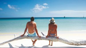
Otherwise, this section is uninhabited. The only downside is that although there are a number of safe anchorages in strong SE winds, only Hunter Island is both safe and comfortable, while in northerly winds Whites Bay on Middle Percy and Hunter Island are in the safe and comfortable category. It is worth hanging out in Island Head Creek or Mackay until the right weather comes. These islands are so beautiful; it is practically a sin to rush through them.
WHITSUNDAYS TO LIZARD ISLAND
 Distance 480 nm, commonly 12-day sails
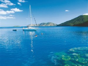
The Whitsunday Islands are the most popular bareboat hire place in the country, and for good reason. There are a number of excellent all-round anchorages, and in the north and eastern sections there are very good coral and clear waters. Many yachts stop here and go no further. It is true that in the season there are lots of boats: in bad weather with the wind expected to swing overnight, all the boats in the islands tend to congregate in three anchorages, and 70 boats in an anchorage does occur. Apart from this, it is always possible to find a nice quiet spot. There are several large marinas at Airlie Beach with overnight berths available, however space is at a premium, so book, preferably by phone, a week ahead and arrive when you say you will.
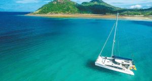 From Whitsunday north there are comfortable anchorages all the way to Port Douglas, some on the mainland and some at islands. The Hinchinbrook Channel gives another inland waterway and a very secure anchorage with good fishing and crabbing if you like that, but this comes with lots of mosquitoes.
North of Cairns, the Great Barrier Reef is close to the mainland and the various reefs are well worth a visit. Lizard is the island that has everything – good anchorages, beaches, wonderful walks, and snorkeling and diving second to none. The island’s peak even has the distinction of having been climbed by Captain Cook, who found his way out past the Barrier Reef by looking from there.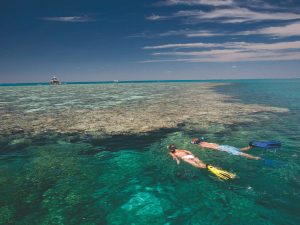
Over the normal cruising months from May to October, the sea state is normally less testing than further south. North of Gladstone there is no ocean swell because of the Great Barrier Reef. The sea is relatively shallow and stronger winds can produce short, steep waves, especially if the wind is blowing contrary to a strong tidal flow. These are not much trouble downwind for a well-found yacht, but can be very uncomfortable upwind.
Tidal currents in this area can be up to 3 knots and constant attention to tides is essential. In Shoalwater Bay ( just north of Island Head Creek) the tidal range can reach 6 metres. The range decreases both north and south from there but it is essential to check expected water depth changes everywhere when anchoring. Near Shoalwater Bay the tide tends to flow east and west, but further south it generally ebbs south and floods north, while north of Shoalwater Bay the tide ebbs north. These general trends are modified near large rivers or inland waterways.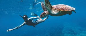
From May to August, the winds almost always blow from the SE. The speed is governed by the size of the high pressure system to the south; a 1040 hPa high will produce 35 knots at the Whitsundays, while a 1025 hPa high produces calm conditions. The nicest conditions are usually in between the highs so the unusual circumstance arises that a dropping barometer in these times often heralds good weather. These trade winds are stronger as you go north and are often stronger offshore than close to the coast.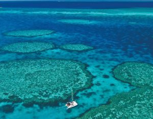
By about mid-September (but this varies from year to year), heat lows begin to form inland and these form troughs in the inter-high periods. As the leading edge of the trough passes the coast, northerlies begin to blow and these winds persist until the axis of the trough passes the coast, when the winds revert to the southeast. Cruising north then is a matter of watching the strength of the SE wind, and waiting out the stronger times. Cruising south is like catching a bus: wait for the trough and be in a suitable port before the axis passes the coast and the SE winds start again.
Once Mooloolaba is reached, the situation changes to weather patterns, more like that in NSW with frontal systems controlling your timing.
 There are a few hazards worth mentioning. If you are sensible these are a minimal threat, but can be nasty if you are not. From Gladstone north (some say Hervey Bay) there are likely to be crocodiles in the mainland streams and estuaries; so swimming in these mainland areas is not a good idea except at recognised places near the main centres. Sharks are not considered a problem for snorkeling in sheltered reefs or diving, but shark attacks have occurred elsewhere so be cautious. From late October to April, marine stingers come down the streams and along the coast; so once again beware of these in mainland areas. It is generally considered that these hazards do not apply to offshore islands.
Coral and coral rubble can cause nasty cuts, and the things that live there can be very bad indeed, even fatal. Most cruising folk always wear shoes when coming ashore except on well-used sandy beaches.
 Insects are a real problem in some anchorages; for example, Sandy Straits (especially the Susan River), the Narrows, bottom end of Port Clinton and Island head Creek, Hinchinbrook and so on. Mossie screens are pretty much essential unless you are happy living in a mozzie coil and insect repellent fog. Sandflies are another pest. Many cruisers do not go ashore after 4pm except in places that are built-up like Hamilton or Airlie. Even at other times it is advisable to spray ankles, shins and calves with tropical strength insect repellent. A good trick is to spray the stuff on your hat instead of your face.
It is very important to have a seaworthy dinghy and a reliable outboard. Anchorage is often a long way from shore and conditions are often choppy with significant tides. An anchor with lots of line and a good pair of oars can make the difference between blowing out to sea or not. Some have a container fastened in the dinghy with spare shear pins, spark plugs and tools plus a flare or two and basic medical stuff.
Wheels on the dinghy save the backs. With big tides and flat slopes on the beaches, long carrying distances are very common.
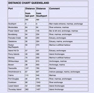
The following table is only for general reference and not for navigation. The decision by any skipper to use a port should be made only after consulting pilot book data, charts, local rescue services, and making a careful personal assessment of conditions. The distances allow for sailing in past the headland or bar. There are many more anchorages than shown.
Published in print July-September 2021


