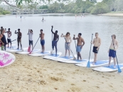
10 Must-Visit Cruising Destinations Around Moreton Bay
By Andy Kancachian
Exploring Moreton Bay is an ambition of many boat owners, dreaming of upgrading the family day boat to a cruiser that is capable of overnight voyages to faraway places.
By doing so, you will finally get to see those much talked about cruising locations, with time to travel and spend the night, rather than rushing home in your runabout before dusk. A beautiful world awaits you!
The aquatic jewel of south-east Queensland, Moreton Bay is bounded by three main islands. Its azure waters cover 3,400 square kilometres.
It will become second nature to navigate with care and look out for cardinal markers. Reefs, rocks, and wrecks are just some of the things you need to watch out for. While the infamous shallow waters require some research and good use of your GPS and Beacon to Beacon maps, with a little preparation, a week-long circumnavigation of the marine park will become a reality.
While you are exploring, do not forget to keep an eye out for the 74 identified species of birds, the dugongs, the turtles, the dolphins, and, of course, the great descendants of the sharks that made the bay such an effective containment area.
May you have fair winds and following seas.
HORIZON SHORES – FUEL, FOOD & SUPPORT
Moreton Bay is very accessible for cruiser boats from the Gold Coast. At the northern end of the Broadwater travelling north through Jacobs Well on the western channel is Horizon Shores Marina. A purpose-built boating facility on the doorstep of the Bay, this is the ideal support destination for onwater fuel, chandlery items and professional marine trade services.
The marina is one of the largest wet berth marinas in Australia with over 500 wet berths catering for mono-hull and multi-hull boats, sizes range from 20ft to 80ft length catamarans, houseboats, and cruising boats.
You will be welcomed with open arms as courtesy berths are available free of charge while dining at The Anchorage Cafe at the heart of the marina. Located directly on the water, the views from the undercover-outdoor dining areas are exclusively nautical. The fully licensed venue allows you to enjoy a peaceful breakfast, a big lunch or a barista-made coffee while listening to the sounds of water lapping against boats.
Marina Location
Latitude: 27° 45.133’S Longitude: 153° 20.856′ E.
COOCHIEMUDLO ISLAND
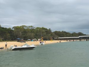 A kilometre off Victoria Point in the Cleveland area is the long stretch of distinctly golden sandy beach of Coochiemudlo Island. The beach is patrolled by the Coochiemudlo Surf Lifesaving Club, distinctly featuring a flagged swimming area to the west of the jetty.
Heading inland, the Curlew Cafe, a bustling little cafe sells essentials like milk and ice. Just a few steps from the beach, there is a public toilet block, beach showers, children’s playground, and free electric barbecue.
About 700 people live on the island, taking advantage of facilities including a nine-hole golf course, BMX track, recreation club, tennis and croquet courts and a library. Bushwalking is also possible with trekking along one of the signposted walks.
The highlight in the annual calendar, is a re-enactment of the landing of Matthew Flinders, on the Sunday closest to 19 July, which is the day the explorer landed on the eastern beach in 1799. A regular craft market always attracts a good crowd.
The deeper-waters and main anchorage on the southern side of the island near the ferry boat is a great spot to spend the day and can be a good overnight anchorage depending on winds as it is exposed to prevailing south-easterlies.
RABY BAY – FUEL, FOOD & SUPPORT
This large seaside township is bustling with specialty stores and cafes that are ideal for resupply. The marina has all-weather access and is only a few nautical miles from the delights of Horseshoe Bay on Peel Island. It is a great spot for a quick return to civilization. The modern boutique-style marina has 75 floating berths nestled in protected waters surrounded by a boardwalk with a selection of bars, cafes, and restaurants for your dining pleasure.
The short-stay overnight berths are wide with lots of room to manoeuvre, with each row individually secured for your peace of mind, and water and electricity supplied to all berths. The canals and marina are dredged to a minimum of 4m draft. Depths outside the marina and canals vary down to 2.1m LAT. The marina houses modern bathroom amenities for guests, and laundry and fully-stocked chandlery are a short walk away. A fuel dock operates on-site 7 days a week, during business hours.
Marina Location
Latitude: 27° 4’11.59″S Longitude153° 8’9.87″E
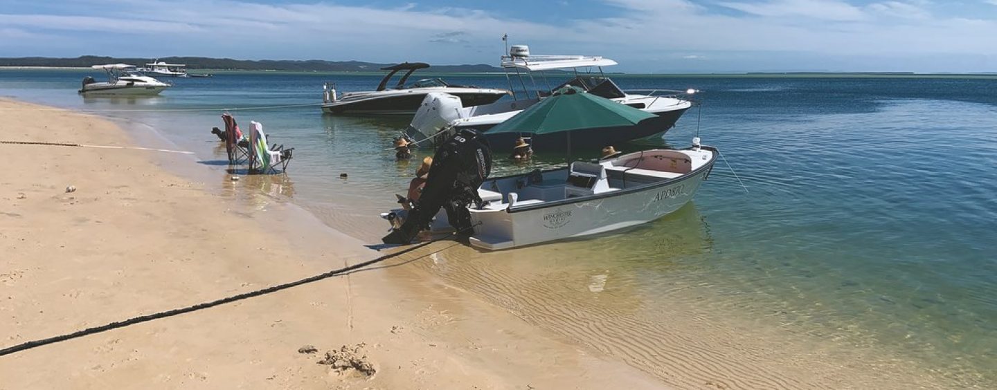
The scenic island is one of Moreton Bay’s most popular getaway anchorages. Horseshoe Bay being the main go-to spot with dozens (sometimes hundreds!) of private vessels anchoring there on weekends and holidays.
It is a great spot for swimming and playing games on the shore, boasting a long sandy beach and some beautiful red sandstone outcrops, this area has good overnight shelter from north-westerly winds. However, watch the low tides as deep water will be more than 70 metres out from the high tide mark.
To the east of the island is Platypus Bay, where a sunken wreck, The Ship’s hull is home to a variety of marine life and is a popular snorkelling destination.
The island was declared a national park in 2007. Called Teerk Roo Ra, which is Aboriginal for “place of many shells”, the island offers many walking paths. Just inland you will find the remains of an old bakehouse-come-jail that was part of the quarantine station. It is a favourite stop for photo-ops.
LITTLE SHIPS CLUB, MINJERRIBAH
Stepping onto North Stradbroke, you are visiting the people of sand and water. The Quandamooka Peoples have lived on the island (known to the local people as Minjerribah) for a very long time, at least 25,000 years.
Pencil in a stop at 70-year-old The Little Ship Club at Dunwich. You can pull up to the beach nearby, or tie up on the back of the jetty, although fees apply for the latter if you decide to stay overnight. A visit to this iconic watering hole and their Black Pearl restaurant is a great way to cap off a day on the island. There is also an outdoor BBQ, and kids’ playground.
When ashore, take the opportunity to explore the island. A very efficient bus system can show you the numerous townships. The island is famous for surfing, diving, snorkelling, 4 x 4 driving, cycling, whale-watching and spectacular ocean view walks. At the northern tip, the township of Point Lookout is a popular hang-out and entertainment district with many cafes and shops.
Just north of the club is The One Mile, a very popular anchorage between Dunwich and Myora. It is landlocked by drying banks at low water, though a roll from south-westerly weather tends to come across the banks round Polka Point.
DAYS GUTTER, MORETON ISLAND
The third largest sand island in the world, Moreton Island is an unspoiled paradise. A huge 95 per cent of the island is a protected national park. At the southernmost tip is Days Gutter with its southern approach offering a very shallow entry so it is recommended to arrive at high tide. It is a very beautiful spot to drop anchor for the night.
The gutter is the breeding ground for many species of marine life. Snorkeling in the waters allows you a glimpse of the various sea life under water. The shoreline is a bright white sand, frequented by 4×4 day trippers on the island and boating families who have come ashore to enjoy a swim or a walk.
No visit to Days Gutter would be complete without a pilgrimage to the “World Famous” Gutter Bar. It is a popular destination for both residents and visitors, where you can watch sporting events on big screens while enjoying fresh seafood sourced directly from the trawlers and oysters straight from the local growers on the island. There is a heap of cold beer available, big servings of hamburgers and chips, and a small convenience section providing basic grocery goods and essential items.
When leaving to the north, only possible at high tide, a very tight partially marked channel can be navigated through Days Gutter, exiting to Moreton Bay at the Little Sandhills.
BRIBIE ISLAND
It is a destination worthy of a few days, even a week. The island has several marinas in sheltered canals and there are shopping centres, cafes, and a long list of surf-and-sand tourist things to do. Separating the island from the mainland is the Pumicestone Passage, a narrow waterway that runs between Deception Bay in the south and Caloundra to the north.
The southern end of the passage is easy to explore, with many coves and inlets for overnight anchorages. For those with shallow drafts and a spirit of adventure willing to attempt the trip through the notoriously shallow passage through The Skids, The Narrows, and The W’s, the wonders of Caloundra waterways await. The whole stretch of the passage is only one-and-a-half nautical miles from beginning to end, yet the high tide varies by one hour and 20 minutes across this short section. The tidal flow is influenced by Moreton Bay at the southern end and the Bribie Bar at the northern end.
Overlooking the pristine waters of Bribie Island is Sandstone Point hotel. Perched on top of the hill, this picturesque icon is an ideal place for lunch or dinner while soaking up the local cuisine and entertainment scene. A long jetty allows for free berthing while at the venue.
SPINNAKER SOUND – FUEL, FOOD & SUPPORT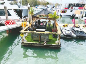
If you need fuel or marine services, then Spinnaker Sound Marina complex is your one-stop-shop, with friendly staff, a range of trades people, and reasonable rates for overnight berths. There is a tiki-style floating marina clubhouse, excellent shower and laundry facilities, and an interesting selection of meals available at the South African-influenced café, which is open for breakfast and lunch, and at the Italian restaurant for dinner.
Marina Location
Latitude: 27° 4’11.59″S Longitude153° 8’9.87″E.
BRISBANE RIVER
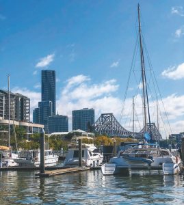 If you seek refuge from the weather on Moreton Bay, the Brisbane River offers calm waters, fuel and service facilities, and the sophistication of city-living when you step off your boat.
An ideal overnight berth is at Dockside Marina at Kangaroo Point, which is situated just minutes from the Brisbane CBD, with public ferry access and public buses a short walk away. The marina offers views of the Story Bridge from each berth. Many of the berths are privately owned with liveaboards, so there is a great sense of community and some very interesting personalities willing to chat or lend advice.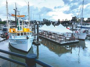
There is a range of berths available from 10 to 40 metres, all with security key access, power, and water, for short to long-term arrangements. It boasts a very clean and modern amenities block and coin-operated laundry facility. On land, at the integrated resort, is a cafe-restaurant and a convenience store. The nightly casual party atmosphere at The Prawnster is a must-do experience. This floating restaurant with two trawlers and a pontoon for dining, provides fresh oysters, bugs, and salmon, with views across the Brisbane River.
Brisbane City’s River Access Network and Recreation Hubs now offer two-hour temporary berthing for day trips to various stops along the river, from Murrarie (downriver) to Riverhills (upriver) recreation hubs.
RIVERGATE MARINA – FUEL & SUPPORT
Just 6 NM from the mouth of the river and 4 NM from the centre of Brisbane, the marina has 3 different boat lifts and is home to more than 320 world-class contractors in over 20 trades. There are two adjacent cafes, and an on-water fuel facility in the D arm open 24 hours, 7 days a week.
Marina Location
Latitude: 27°26.67’S Longitude: 153°06.30’E
IMPORTANT WARNING: – Moreton Bay is recognised as one of the most important marine habitats along the east coast of Australia. It is a transitional area in which tropical, subtropical, and temperate marine species co-exist, creating distinct and harmonious wildlife and habitat communities. So, understanding your responsibilities as a steward of these waters is vital for the sustainability of the area. Although it is renowned for fishing, restrictions on recreational activities apply in many places, so check the Moreton Bay Marine Map before wetting a line.


